Trekking
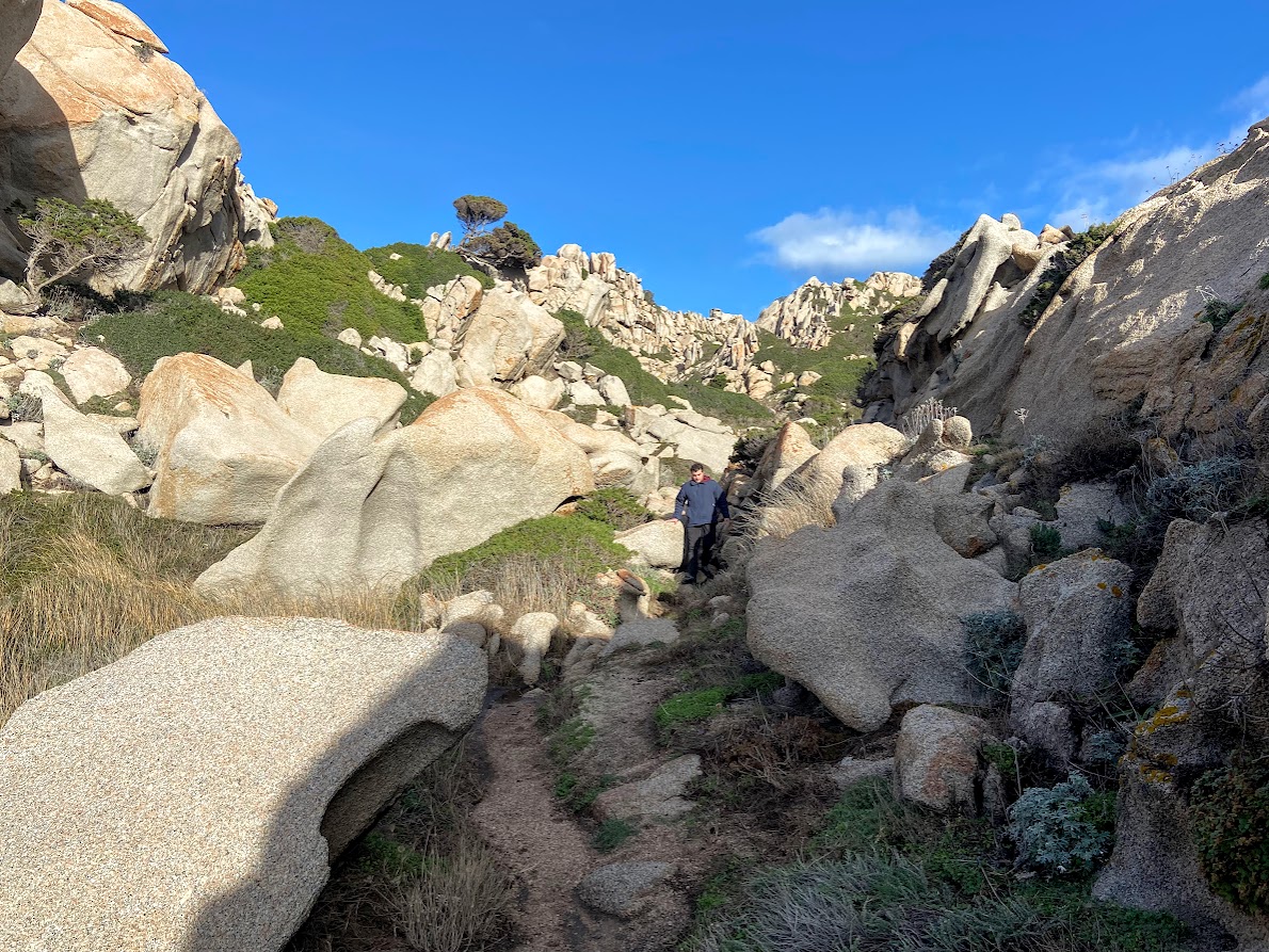
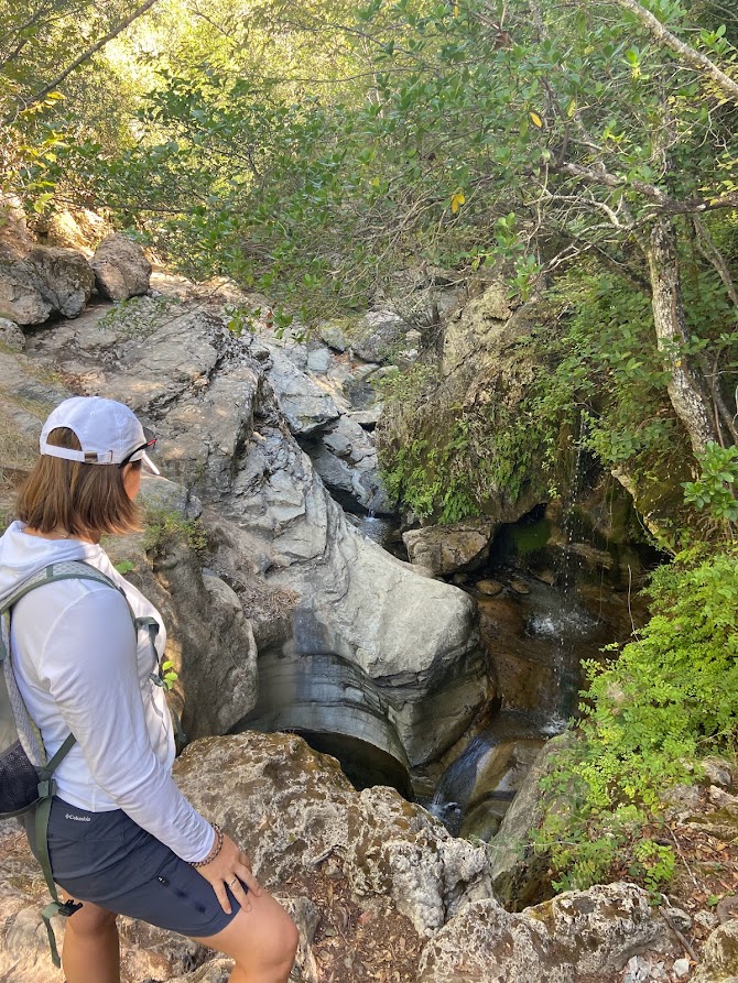
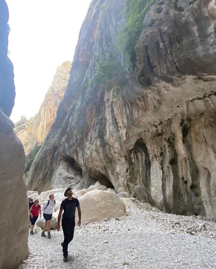
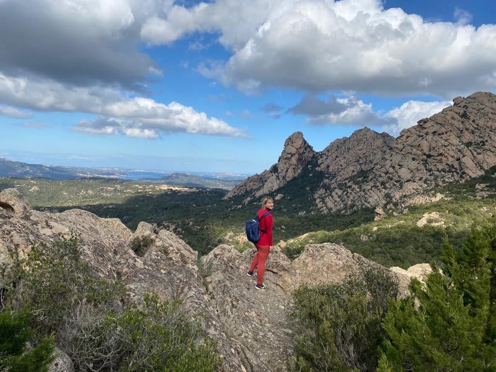
In Sardinia, there are countless hiking trails, which are divided into categories according to difficulty by the established standards. Trails marked T (turistico) are easily visible, do not involve major height differences and are not significantly physically demanding. Thus, are suitable for people with a basic knowledge of hiking. The largest number of routes are marked E (escursionistico) that indicates those with variable terrain, which may include steep hills or rocky narrows. To successfully overcome them you might need to use your hands as a support. A good sense of direction, adequate physical condition, and especially adequate footwear are required. Double E (EE – escursionisti esperti) stands for routes that require the ability to cope with impassable paths, unstable surfaces and to be prepared for all sorts of slopes, traverses and rock sections. The last level is the EEA category (escursionisti esperti con atrezzature), which includes the so-called Via Ferrata; routes with special structures that require special equipment. With the help of harnesses, ropes, helmets and appropriate technical preparation, and possibly even with an experienced guide, you can go to places which ordinary tourists won‘t reach, and which will provide you with unique views of the local nature. A challenging and unique hike passes through the peaks of the Gennargentu mountain range and reaches Sardinia’s highest mountain, Punta La Marmora (1,834 meters). During a four-hour hike through the mountains, you can admire the east-coast landscape, spot mouflons and golden eagles. The route starts in the deepest part of the Ogliastra region, in the Nuragic village of Ruinas, and climbs towards Florisa, La Marmora and ends at the peak of della Croce, on which there is the iron cross, a landmark for hikers climbing the mountain massif. The entire Ogliastra region on the east is criss-crossed by routes that will take you past impressive vertical rocks, holly-oak forests, springs and lakes, domus de Janas fairy houses, Nuragic villages and ancient shepherds’ shelters. On the routes along the Sentiero delle Aquile you can discover fabulous places such as the natural oasis of Is Tostoinus, in the forest of Montarbu you can choose the easy route around the Rio Ermolinus stream and admire s’Ilixi e Canali, an 18 m high holly oak tree. During the three-kilometre journey, named after the Su Marmuri cave in Ulassai, you can stop at panoramic points over the valley of Rio Pardu and Santa Barbara. Or enjoy the trail dedicated to Ulassai artist Maria Lai, which is littered with her works. One of the most captivating routes is leading to the impressive limestone rock of Perda ‘e Liana, in the territory of Gairo Sant’Elena. Inland, on the way from Villanovatulo to Seulo, you can come across the areas once frequented and inhabited by shepherds and coal miners. The route from Pala de Nuraxi to the Addoli forest passes through various natural monuments, such as the cave of Is Janas, according to legend the home of mythological figures. A few steps from the cave you can find hidden fascinating su Stampu ‘e su Turrunu waterfall, where the water flows out of a rock sink and creates a small lake. From Funtana Maore to Genna ‘e Teula you can discover many places of great landscape and cultural value, and with a bit of luck you might spot Sarcidan horses or Sardinian deer. Less challenging routes lead from Sadali to Arcu ‘e Spineddai or from the Pranedda Oliastru lookout, offering the amazing view of the Flumendosa river valley up to the Adoni nuraghe. The most famous, and undoubtedly the most demanding of the Sardinian trekking, is Selvaggio Blu. The 50 km route runs from the tourist port of Santa Maria Navarrese to Cala Gonone. A several-day trip over the peaks above the Gulf of Orosei includes climbing and via ferrata sections. There are no refreshments on the way, so it is important to be properly prepared, to have enough water and food with you and maybe an experienced guide as well. For amateur tourists, if necessary, the route can be divided into shorter parts and modified into a simpler version, without climbing or abseiling. Most of the famous wonders of the East Coast can only be reached on foot, except by water transport. It will take you an hour and a half to descend to Cala Goloritzé, a bay with a famous beach and the limestone monolith of Aguglia, which dominates over it and is the popular destination for climbers from all over Europe. Even more demanding is the route to Cala Mariolu, a beach of small round pebbles, which takes six hours and is recommended with a local guide. The Supramonte mountain range offers other countless wonderful destinations. Among them is Gorropu Canyon, one of the deepest canyons in Europe, with walls of 500 meters high, which you can reach by 3 different routes of varying difficulty. The area around Siniscola, Lodé and Lula is crossed by many tourist routes. The ridges of Monte Albo to the Tuttavista massif, through which the rivers Isalle and Cedrino flow, are home to many rare species. They are characterized by vertical slopes, cut by deep gorges of an elongated shape and rich in notches and caves such as Bona Fraule, Janna Manna and Omines Agrestes.